Land Use/Cover Change Mapping.
This is a brief presentation of my Bachelor’s Thesis, which is Mapping Land Cover and Land Use Change in Laikipia County
Author:
Michael Mwaruah
Advisors:
Jasper Mwenda (Professor)
Author:
Michael Mwaruah
Advisors:
Jasper Mwenda (Professor)
Description:
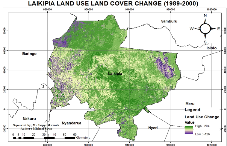
This is a geospatial analysis of land cover and land use change in Laikipia County using remote sensing and GIS techniques. The project involved satellite image processing, classification, and change detection to assess environmental and land use dynamics over time.Full project available here
Please feel free to contact me at my email address or through my LinkedIn Account below.
mikesirya@gmail.com